| In September 2005, the Federal Highway Administration named the Catoctin Mountain Scenic
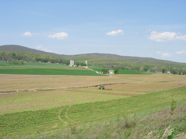
Byway as a National Scenic Byway. Catoctin Mountain – the ecologically diverse, easternmost spur of the Blue Ridge Province – spans multiple states
and is split by a gap caused by the Potomac River. The landform rises to its greatest elevation of 1,885 feet above sea level in Thurmont’s Catoctin Mountain Park. The
hardwood forests encircling Catoctin Mountain are a natural wonderment, serving as a sanctuary for wildlife and plants. Surrounding towns offer a deep exploration of the
area’s rich heritage and culture.
Covering 38.5 miles, a modern roadway runs along the
eastern side of Catoctin Mountain through Frederick County, Maryland.
From
south to north, the Catoctin Mountain National Scenic Byway begins at the Point of Rocks Bridge at the Potomac River (and Virginia border) and winds along the picturesque landform up
to Emmitsburg and the Mason Dixon line (Pennsylvania).
Let us be your guide as you discover the beauty and many attractions, historic sites, and Civil War heritage
that encompass the Catoctin Mountain Scenic Byway. The Catoctin Mountain scenic byway is a great way to get away for the day or weekend. Download the Catoctin Mountain Scenic Byway Brochure (Driving
map and Guide). |